Herschel Island
 Herschel Island and the neighboring Mackenzie Delta is a secondary field site in PAGE21. The island is located at 69°34'N and 138°55'W and is the northernmost point of the Yukon Territory, approximately 60 km east of the Alaska border. Herschel Island is part of an ice-push structure formed by the westward advance of a lobe of the Laurentide Ice Sheet during the last glaciation.
Permafrost is relatively thick and, in places along the Yukon Coastal Plain, reaches depths of 600+ m (Smith and Burgess, 2000). Massive ground ice is widespread and underlies most of Herschel Island, except for beaches and spits (Pollard, 1990; Fritz et al., 2011). The mean long-term annual air temperature is -10°C and permafrost temperature at -15 m depth is −8°C (Burn and Zhang, 2009).
The area is characterized by Arctic tundra. There are over 200 species of plants on Herschel Island, which occur in a diversity of habitats. Most of the island is composed of level to gently sloping stable uplands, vegetated by cottongrass, ground shrubs and wildflowers.
The island is the focus of the investigations of the Alfred Wegener Institute for Polar and Marine Research since 2006 in a cooperation with McGill University and the Geological Survey of Canada. These studies have looked at coastal erosion, paleogeography, thermokarst and soil microbiology.
 A large number of background documents and data have been acquired about the island and the area, including high resolution satellite imagery, DEMs, archive airphotos, meteorological measurements and soil maps.
The island can be accessed by helicopter, float plane or twin otter from Inuvik. The Twin otter flight lasts approximately one hour. The number of researchers on site varies between a few to fifteen at the same time during the summer period. The island is a territorial park and is being managed by two rangers on site between April and August.
In PAGE21, following research will be conducted at Herschel Island:
-
Measurement of permafrost temperature
-
Active layer depth monitoring
-
Creation of soil maps
-
Creation of gemorphological maps
-
Measurement of coastal erosion and thermokarst.
-
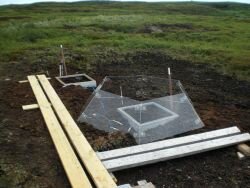
Sampling of soil pits
-
Microbial analysis
-
CO2 and CH4 exchange from polygonal tundra (techniques: chamber techniques, eddy covariance for CO2 planned for 2013 onwards)
-
Meteorological measurements including soil heat flux and radiation balance
For more information, please contact:
Dr. Hugues Lantuit at the Alfred Wegener Institute for Polar and Marine Research, Periglacial Research Section
Telegrafenberg A43, 14473 Potsdam, Germany
Phone: +49 331 288 2216
Fax: +49 331 288 2188
Email: This email address is being protected from spambots. You need JavaScript enabled to view it.
Field Trips
- Summer 2012:
The team is on Herschel island from 17 July until 28 August. You can follow their research experiences in the blog "Herschel Island 2012". - Summer 2013
- The team from from the Alfred Wegener Institute (AWI) in Potsdam, McGill University, Montreal, and the University of Edinburgh was blogging in English. Their stories are available here.
Vorkuta/ Seida

Vorkuta/ Seida, is a secondary field site in PAGE21. It is located in the Eastern European tundra near the village of Seida, NW-Russia, and about 70 km away from city Vorkuta (67⁰07´N, 62⁰57´E, 100 m a.s.l.). The climate is subarctic, with a growing season of about 3 months, lasting from mid-late June from early-mid September. The site is located in the discontinuous permafrost zone in Komi Republic. Mean long-term annual temperatureis -5.6 ⁰C.
The area is characterized by various landcover and soil types, e.g. tundra heath, peat plateau, fens and lakes representing the typical mosaic-like southern tundra landscape. Peat plateaus, permafrost peatlands with thick peat deposits, are spotted by peat circles (bare peat) which have developed as a result of frost action. These peat circles have been recently identified as hotspots of the strong greenhouse gas N2O (Repo et al., 2009).
Soil, vegetation and flux measurements began in 2007 during the EU project CARBO-North, where the site was selected, and continued since then. University of Eastern Finland (UEF), which is coordinating research in Seida, is mostly focusing on the greenhouse gas dynamics (CO2, N2O, CH4). Detailed soil, vegetation and digital elevation maps as well as high-resolution satellite images are available. Since 2011 open top chambers (OTCs) are operating at the site simulating climate warming.
The village Seida is well connected with train, and field site is about 6 km away within walking distance. Between 10 and 15 people are usually staying for field work during the summer period.
 Within PAGE21, following research will be conducted at Vorkuta/Seida:
- - CO2, N2O and CH4 exchange from dominant land cover types including peat circles (techniques: chamber techniques, eddy covariance for CO2 and N2O planned for 2013 onwards)
- - Meterological measurements including soil heat flux and radiation balance
- - Auxiliary soil and plant analysis (e.g. exchangeable nutrient pools, LAI, monitoring of soil temperatures and active layer depth)
- - Microbial analysis (including molecular markers)
For more information, please contact: Dr. Christina Biasi at the University of Eastern Finland, Department of Environmental Science, Biogeochemistry Research Group, PL 1627, FI-70211 Kuopio
Phone: +358 404 355 3810
Fax: +358 17 163750
Email: This email address is being protected from spambots. You need JavaScript enabled to view it.
Field Trips
A researcher team from the University of Eastern Finland stayed in Seida for the summer field season 2012. You can read their blog from the site in English in here.
Blog from Seida 2013 research expedition, written by Richard and Carolina from the University of Eastern Finland is available here.
Zackenberg
Zackenberg Research Station is located on the north side of the Young Sund - Tyrolerfjord fiord complex in Northeast Greenland (74º30' N, 21º00' W). The station is situated in the southern part of the National Park of North and East Greenland, the largest national park in the world (c. 1 mio. km2). Nearest settlement is the military outpost Daneborg, 20 km southeast of the station, and nearest town is Ittoqqortoormiit, 450 km south of the station.
The station mean annual temperature is -9.2 degrees Celsius, the mean temperature being in February -20.1 degrees Celsius and in July: 5.2 degrees Celsius.
 The study area at Zackenberg comprises the entire catchment of the river Zackenberg, totaling about 500 square kilometers. It provides facilities for specific but comprehensive research projects and for long-term monitoring grouped around five systematic programs (ClimateBasis, GeoBasis, BioBasis, MarineBasis and GlacioBasis).
ClimateBasis is monitoring of the climate, GeoBasis is monitoring of the physical landscape processes, Biobasis is the monitoring of the living nature, MarineBasis is monitoring plant- and animal distribution and GlacioBasis is monitoring the mass balance of a glacier. At the station there are approximately ten ongoing projects per year, of which approximately two thirds are Danish projects with focus on climate change feedbacks.
During the fall of 2013, PAGE21 Young Researcher Stefanie Härtel visited the site. Blog from her expedition is available here in English.
For more information, please contact the Zackenberg Secretariat at the department of Bioscience
Fredericksborgvej 399
DK-4000 Roskilde
Denmark
Phone: +45 87158734
E-mail: This email address is being protected from spambots. You need JavaScript enabled to view it.
or visit the station website
For more information, please contact the Zackenberg Secretariat at the department of Bioscience
Fredericksborgvej 399
DK-4000 Roskilde
Denmark
Phone: +45 87158734
E-mail: This email address is being protected from spambots. You need JavaScript enabled to view it.
or visit the station website
Svalbard
 The primary PAGE21 site in Svalbard is consisting of two separate fieldsites (Ny Ålesund and Adventdalen), which together provide a complete coverage of the environmental gradient from very maritime to less maritime conditions and the necessary PAGE21 field measurements.
On 26 March 2012 a large PAGE21 permafrost drilling campaign was conducted in Adventdalen, led by the University Centre in Svalbard: "During 10 days we aim to collect between 60 and 100 metres of permafrost cores from ice-wedge polygons, pingos and solifluction sheets in Adventdalen.
In Svalbard, we have so far only been able to obtain hand drilled permafrost cores down typically 2 metres into the permafrost top. However, with the combination of funding from PAGE21 and from a collaboration project with the University of Alaska Fairbanks, called SVALASKA, we have been able to buy a specially designed hydraulic drill rig, which is able to collect cores from the permafrost in both sediments and bedrock down to potentially 50 metres depth.", says Hanne Christiansen, Professor in physical geography and leader at the project partner UNIS for the PAGE21 project.
PAGE21 summer expedition to Svalbard took place in April – May 2013. Story of the research expedition is available here in English.
Abisko

The Abisko Research station is located at the shore of Lake Torneträsk in Northern Sweden (68º 21' N, 18º 49' E) approximately 200 Kilometer north of the Arctic Circle. At the site can be found a wide range of ecosystems from pine forest at low altitude in East to alpine tundra in the west. Main human activities in the area include reindeer husbandry, fishing, hunting tourism and research.
The emphasis of staff research is on plant ecology, geomorphology and meteorology. The main objectives of the ecological projects are to study the dynamics of plant populations, to identify the controlling factors at species latitudinal and altitudinal limits, to understand ecosystem structure and function and to predict impacts of global environmental change. The meteorological projects deal with recent climate changes in the region, and also with local variations of Online Poker the microclimate in sub-alpine and alpine ecosystems. The geomorphology research focuses on the mass wasting of mountains and sediment transport.
The emphasis of staff research is on plant ecology, geomorphology and meteorology. The main objectives of the ecological projects are to study the dynamics of plant populations, to identify the controlling factors at species latitudinal and altitudinal limits, to understand ecosystem structure and function and to predict impacts of global environmental change. The meteorological projects deal with recent climate changes in the region, and also with local variations of Online Poker the microclimate in sub-alpine and alpine ecosystems. The geomorphology research focuses on the mass wasting of mountains and sediment transport.
Parameters relevant for PAGE21
-
-
- Meteorology with records from 1913 to present
- Permafrost deep borehole
- CO2 monitoring
- CH4 monitoring
- N2O monitoring
- Energy exchange
- Soil Carbon inventory
- Spectral monitoring
-
For more information on Abisko field site, please contact Site manager: This email address is being protected from spambots. You need JavaScript enabled to view it.
, Abisko Scientific Research Station, S- 981 07 Abisko, Sweden
Phone: +46 980 401 79 Fax: +46 980 401 71 or visit the Abisko station website
Field Trips
A research team form the Lund University stayed in Abisko during summer 2012. You can read their blog in here.
At the end of summer, PAGE21 young researcher Elin Högstöm from Vienna University of Technology traveled to Abisko and told about her work through the blog which is available here.


